European Wetland Map Launched on World Wetlands Day
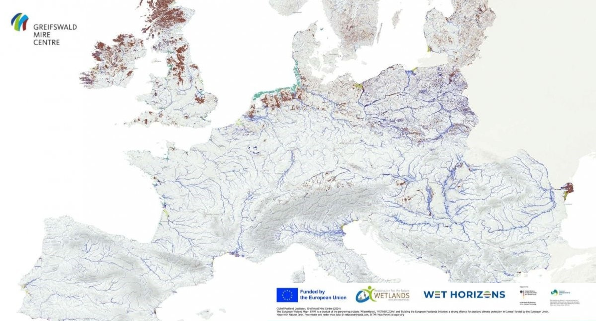
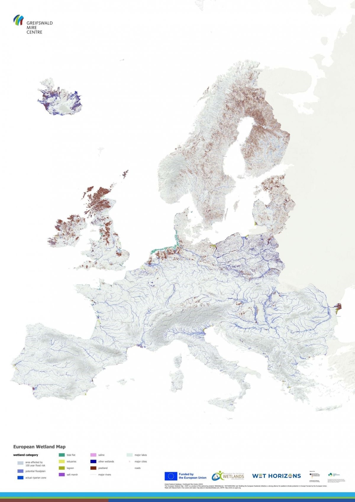
To mark World Wetlands Day 2025, the first version of the European Wetland Map (EWM) was officially launched. This new tool represents a significant advancement in understanding wetland distribution and types across Europe.
Developed using the latest geospatial and GIS data, the EWM provides a comprehensive overview of wetlands—both on mineral soils in coastal and floodplain environments and across a wide range of peatland ecosystems. The map merges diverse data sources into a single, user-friendly format to support wetland research, restoration, and policy.
Available in multiple formats, the dataset includes:
- A vector dataset on wetland distribution, by country
- A collection of high-resolution GeoTIFF files (1 arcsecond grid size) for detailed national mapping
The EWM was created under the ALFAwetlands and WET HORIZONS research and innovation projects, funded by the Horizon Europe Framework Programme. It also received support from the European Peatland Initiative, funded by the European Climate Initiative (EUKI) under the German Federal Ministry for Economic Affairs and Climate Action (BMWK). The Michael Succow Foundation and the University of Greifswald led the technical development of the map. Both are partners in the Greifswald Mire Centre.
The European Wetland Map provides a vital reference for conservation practitioners, land-use planners, researchers, and policy-makers. This map will contribute to better decision-making for wetland protection and restoration in Europe.
Access the dataset: Download the European Wetland Map

Author: admin
admin account